


Huynh Quyet Thang (R), 40, who is also a tour guide, first explored Cao Bang on a motorbike in 2019. But his passion for cycling took him back to this mountainous region this fall.
"Cao Bang may not boast the grandeur of Ha Giang Province nor the districts of Sa Pa or Mu Cang Chai, but it offers a harmonious blend of mountains, rice fields, rivers, and warm-hearted people," he says.
In recent years Cao Bang has made great efforts to develop tourism and improve its infrastructure, making travel, dining and accommodation increasingly more comfortable.

Thang and his group embarked on a five-day, four-night trip. They flew from HCMC to Hanoi, drove down by car to Bac Kan Province and finally reached the provinces of Cao Bang and Lang Son. Of these destinations, Cao Bang left the deepest impression on him.
The cycling route in Cao Bang spans around 125 kilometers, and involves two days of riding. It is 45 kilometers from Bao Lac City to Cao Bang and 80 km from Cao Bang to Ban Gioc Waterfall.
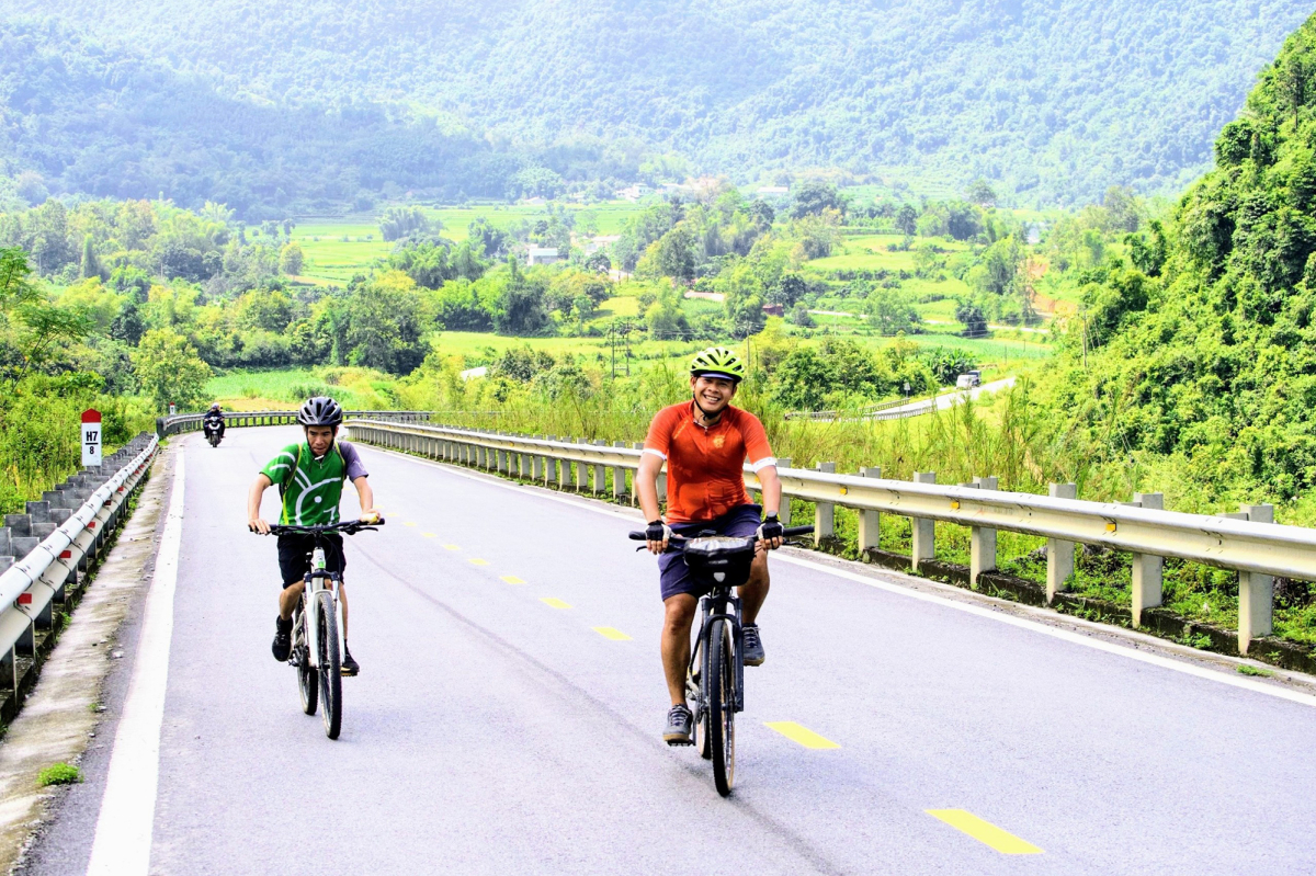
The picture shows a peaceful road by a stream from Thong Hue Commune in Trung Khanh District.

One of the most captivating but difficult parts is the Khau Coc Cha Pass linking Xuan Truong Commune and Bao Lac Town. In the Tay language, "Khau" means "pass," and "Coc Cha" is the name of a tree found at the top of the pass. The group has to handle steep slopes with inclines of more than 10%.
This 2.5-kilometer pass has 14 bends. It used to be a narrow 40-centimeter path, but in 2011 Cao Bang authorities widened it into a 5-meter-wide concrete road. It is now considered one of Vietnam's 10 most charming passes, and attracts adventurers from various places.
Thang describes their journey to the pass in rain, where slippery trails made it possible for only two of their members to reach the top by climbing (in the photo) while the rest continued cycling.

Lung Mat Village in Xuan Truong Bao Lac Commune, predominantly inhabited by H’mong and Dao people who grow corn.

Na Tenh Pass, which translates into "high field" in the Tay language, is situated in Can Nong Commune, Ha Quang District, near the China border and around 15 kilometers from Khau Coc Cha Pass.
Thang's group found this to be one of the most scenic yet gentle passes in Cao Bang, with its meandering bends amid green terraced fields.

The group rode in Keng Ma Pass, which is a kilometer long, in Trung Phuc Commune, Trung Khanh District, about seven kilometers from Trung Khanh City on the route to Ban Gioc.
The pass is situated on the road between Canh Tien and Trung Phuc communes in Trung Khanh District. It is in a limestone area and not as challenging as Na Tenh Pass.

Their journey from Cao Bang to Ban Gioc in Quang Uyen District was greeted by lush cornfields and golden rice paddies awaiting harvest by the Tay and Nung people.

Ban Gioc Waterfall, towering over 70 meters, is in Dam Thuy Commune, Trung Khanh District, and serves as a customary stop for the group during its Cao Bang cycling expedition.
In the rainy season the Quay Son River ensures a continuous flow of water, creating a breathtaking spectacle.
"Standing before this waterfall, I feel insignificantly small," Thang says.

The 3.5-kilometer Ma Phuc Pass marks the end of the 85-kilometer cycling journey. It is on Highway 3 in the border region between Hoa An and Quang Hoa Districts.
This pass, 620 meters above sea level, is embraced by two limestone formations that bear a striking resemblance to reclining horses.
This likeness led to the pass being named "Ma Phuc Pass" in which "Ma" means horse and "Phuc" means lying down.
Users need to navigate seven bends to reach the top. The Coc Phat junction is where the pass ends, and Provincial Road 205 to the Tra Linh border gate in Trung Khanh District, a trade hub connecting Vietnam and China, begins.
Dan Chuong, 46, found Cao Bang alluring. She described the cycling expedition as a miraculous experience, one that pushed her to her limits.
She eagerly awaits a return to Cao Bang to explore other gems like Pac Bo village, Dung Mountain, and Phong Nam Valley.

Thang says cycling provides a special way to travel at a pace that lets you enjoy every moment, connect with nature and people and develop a deeper appreciation for Vietnam and its people while also understanding oneself better.
Cycling demands physical fitness, mental resilience and determination. Proficiency in cycling techniques and practice on mountain passes are also essential.

According to Thang, meticulous preparation is the key when organizing a bicycle tour, covering accommodation, logistics and technical support along the route. The group opted mostly for picturesque, less crowded roads for cycling and switched to cars on less scenic routes.
Throughout the journey, they had trucks and cars to assist tired riders and provide them with water, food and energy drinks. The group also had a bicycle repairman.