


People have moved their cars to the highest point in Hue to protect them from waters.
The area is an observatory constructed during the reign of King Minh Mang (1820-1841).


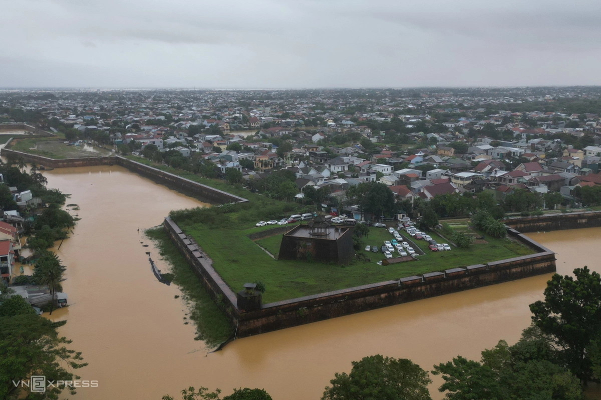
Da Vien Islet, located in the middle of the Huong River, was completely submerged. The normally emerald-green water had turned murky brown.

Covering about 10.5 hectares, the islet was once an alluvial land where the Nguyen Dynasty (1802–1945), the last Vietnamese dynasty, hosted elephant and tiger fights.

Nguyen Hue Street, in the heart of Thuan Hoa Ward in the city center, was flooded under more than one meter of water, making it impassable for vehicles.
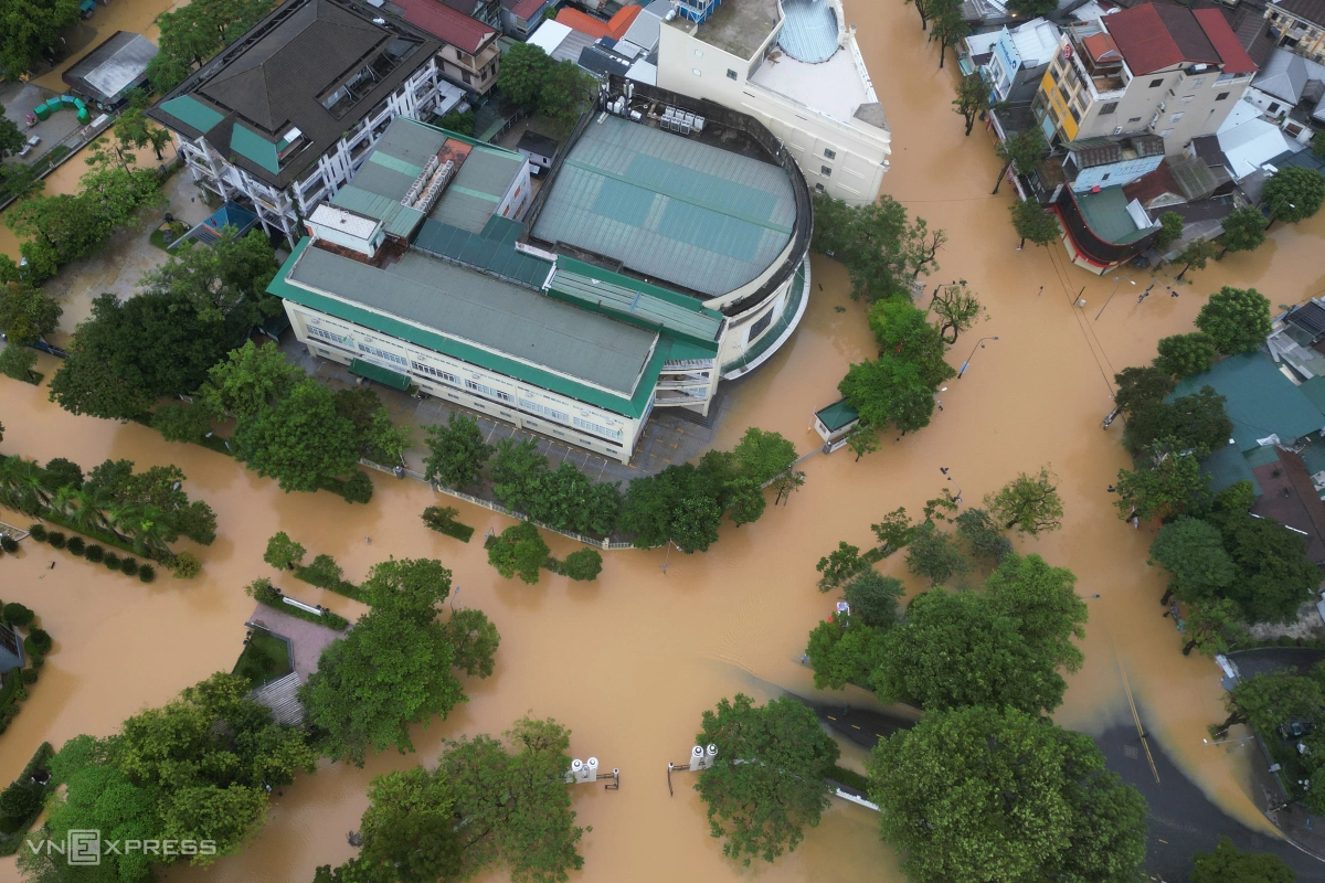
At the intersection of Dien Bien Phu and Nguyen Hue streets, floodwaters spread extensively. As a result, all students in the city were given the day off on Tuesday, and many offices allowed employees to work remotely or take leave due to the flooding.

Next to the Hue City People’s Committee office, both the Hue High School for the Gifted and the War Memorial were inundated.

Tourists wade along Le Loi Street to reach Hue Railway Station, as train services were disrupted due to the tracks being submerged under 15–20 cm of water.

Water from the Huong River flowed into the Hue City People’s Committee building on Le Loi Street, causing flooding of up to 0.5 meters on Tuesday morning.
A total of 32 out of 40 communes and wards in Hue are now flooded, as the city has become the epicenter of the flood crisis in the central region.
Since Oct. 23, heavy rain has affected provinces from Quang Tri to Quang Ngai, which border Hue to the north and south, driven by cold air, the intertropical convergence zone, and easterly winds. Rainfall has been especially intense since Oct. 25, with totals from the evening of Oct. 24 to Oct. 28 ranging from 500–700 mm in Hue. In some areas, it has exceeded 1,000 mm, including 2,785 mm at Bach Ma peak, 1,484 mm at Khe Tre, and 1,270 mm at Huong Son.

Floods submerged the Imperial City of Hue, Oct. 28, 2025.